GRACE shaping up to follow FRED towards Florida.
From west to east;
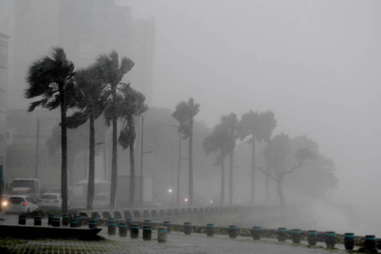
FRED is skirting the northern coast of Cuba, situated around 90 miles south-east of Florida Keys headed west-nor’west at 10 knots. This system has remained weak for over 24 hours now and as a consequence, the likelihood of this becoming a strong tropical storm is diminishing. Nonetheless, this is expected to rejuvenate as it turns slightly more towards the north and runs parallel to the east coast of Florida on Monday. This is now likely to be further offshore than originally expected although the strongest sector will still be over the coast. With a maximum predicted hurricane severity index rating of just 3 (1 for size and 2 for intensity) producing winds gusting 45 knots and a tiny windfield radius of 70 miles, FRED is unlikely to have any powerful impact ashore even at landfall along the Florida panhandle on Monday evening.
Disturbance Twenty Seven is centred about 320 miles north Puerto Rico moving to the west-nor’west at 18 knots. This is well north of the convergence zone and does not appear to be organising with anything deep and meaningful aside from the odd thundercloud.
Tropical storm GRACE is now a day’s steaming east of the Leeward Islands headed west at 20 knots producing winds gusting 50 knots. This is expected to track across the islands reaching Puerto Rico tomorrow and thereafter, follow FRED across Hispaniola weakening as it does so. Land interaction with Cuba on Tuesday will weaken the convection cycle, but thereafter the track is uncertain, but is expected to head somewhere between the Bahamas and eastern Gulf of Mexico, which is likely to include Florida in some shape or form.
Disturbance Thirty has appeared south of the Cape Verde Islands moving west at 14 knots. Development prospects are currently poor but may improve as it tracks west.
Stand by for tropical storm force conditions over Florida Keys and along the western coast of Florida.
Image Dimitris Sirinakis