SAM posing long term threat to Bermuda
From west to east:
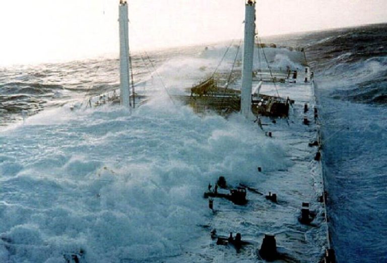
Category Four hurricane SAM is currently 580 miles east of the Lesser Antilles headed west-nor’west at 8 knots. Maximum sustained wind speeds of 120 knots have been reported, along with gusts of 140 knots. This is close to peak now with a hurricane severity index rating of 23 out of a possible 50 points (7 for size and 16 for intensity) . In the eye of the storm, peak seas of 40 feet are being experienced over and above a violent high swell. This is a very concentrated and powerful storm which would be very destructive were it nearing land. As things stand, SAM is expected to continue on this track for the next few days and pass well to the north-east of the Leeward Islands although the storm-generated swell will reach the Lesser Antilles today with life-threatening surf and rip current conditions. By Thursday, SAM is expected to be tracking more towards the north and is likely to be nearing Bermuda, still as a strong hurricane, on Friday. There is still time for wobbles and intensity fluctuations with some inevitable weakening, but few observers would seem to be disagreeing with a strong possibility of this being bad news for Bermuda.
To the north-east of SAM, the remnants of Tropical Storm Peter are now held in a weak trough of low pressure loosely centred 250 miles east of Bermuda. This will track north-east over the next few days where development conditions are becoming more favourable for development, albeit short-lived before disappearing into the north-Atlantic autumn gloom.
Disturbance Fifty One is 900 miles north-east of the mouth of the Amazon moving west at walking pace. Conditions are becoming increasingly favourable for development although short-lived, and anything that does take shape is expected to weaken before this reaches the Caribbean.
Disturbance Fifty slipped the African coast this morning with a twinkle in its eye. This already has defined surface rotation and is fanning out line squalls with significant thunderstorm activity. Conditions are expected to be favourable for development as this tracks west. One or two of the usual catastrophists are already plotting a map of destruction. Utter nonsense. This may become a Gulf of Mexico-bound hurricane but by the same token, may not. Where this goes and how strong it will be is pure conjecture at this stage.
Stand by for muck and filth at sea from SAM, otherwise stand easy.