Category three hurricane FIONA producing life-threatening conditions.
From west to east;
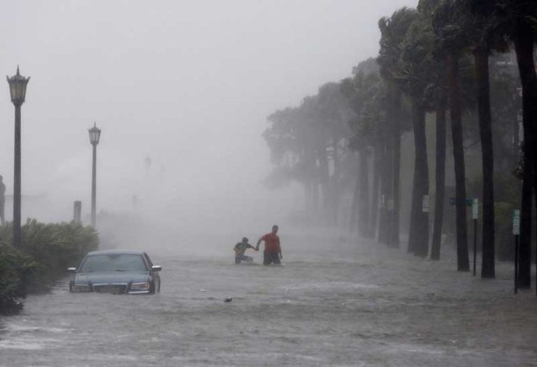
Destructive category three hurricane FIONA is now just 20 miles east of Grand Turk Island where conditions are deteriorating rapidly and a life-threatening warning has been issued. FIONA is currently headed north-nor’west at 8 knots producing winds touching 105 knots with a windfield radius of just 115 miles. This is a beastly little hurricane which has had a devastating impact over Puerto Rico and the Dominican Republic mainly from mudslides and flash flooding. Several more inches of rainfall will be possible there before tapering off later today but at least two fatalities have been reported with widespread power outages. FIONA currently has a hurricane severity index (HSI) rating of 18 out of a possible 50 (6 for size and 18 for intensity) but is not yet at peak. After clearing the Turks and Caicos Islands, FIONA is expected to peak as a category 4 hurricane with wind speeds close to 130 knots and a windfield radius of 300 miles as it turns to the north overnight which is expected to bring it close to the west side of Bermuda on Thursday. This equates to an HSI rating of 30 (15 each for size and intensity). Bermuda is not expected to take a direct hit per se but will be subject to hurricane force gusts and hurricane force sustained winds may be possible. Thereafter FIONA is expected to turn in a north-nor’easterly direction and pass close to the east of Nova Scotia on Friday night and then to the west of Newfoundland by the weekend but with continued hurricane force winds.
Maverick Disturbance Thirty One is now about 1110 miles east of Bermuda moving to the north-east at 10 knots. This is well to the north of the established development track and an unlikely prospect but aerial images show some sign of rotation and it could become a tropical depression or a weak tropical storm before it merges with an advancing cold front on Thursday.
Disturbance Thirty Two is now two days’ steaming east of Trinidad moving to the west at around 15 knots. This has some scattered showers and thunderstorms associated with it, but interaction with the coast of south America is likely to put the mockers on development until it enters the Caribbean on Thursday. Thereafter, environmental conditions are expected to be more favourable for tropical development.
Stand by for life-threatening hurricane conditions across the Turks and Caicos Islands and in the western Atlantic.