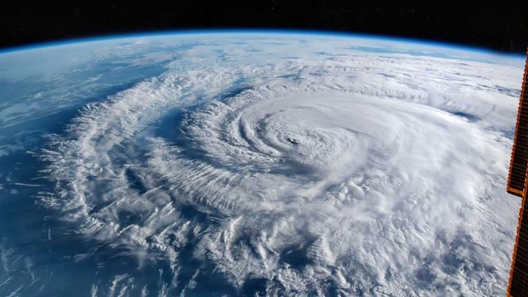
Category four hurricane FIONA set to brush Bermuda and make peak landfall over Nova Scotia

From west to east;
Category four hurricane FIONA is 480 miles southwest of Bermuda headed north-nor’west at 14 knots. This is a very powerful storm indeed. Currently producing winds gusting 150 knots – take off speed for a Boeing 737 – with a tropical storm windfield radius of 200 miles, this has a hurricane severity index rating of 28 out of a possible 50 points (13 for size and 15 for intensity). A continued north-nor’westerly track for the next couple of days will take FIONA close to the west of Bermuda tonight. One or two agencies are commenting on early signs of eyewall decay, but this is unlikely to weaken FIONA and with a hurricane force windfield radius of 70 miles within the 200 mile tropical storm windfield radius, it is likely that Bermuda will feel the full cyclone intensity with up to 6 inches of rain to be expected, observed 38 foot wave heights and a heavy swell with inevitable destructive storm surge. Despite this ominous report for Bermuda, there is worse to come. FIONA is not yet at peak and likely to develop further once Bermuda is past and clear when it is expected to reach an HSI rating of 30 (15 each for size and intensity) which will not significantly increase wind speeds but will produce a windfield radius of 300 miles. Early indications show that FIONA will maintain intensity as it moves north to make landfall at peak intensity over Nova Scotia to the east of Halifax on Saturday with a risk of wind gusts to hurricane force in the city with damaging tidal surges. The strongest winds will likely occur in the Cape Breton area. After impacting Nova Scotia, FIONA should slow down as it moves west of Newfoundland and into Quebec and Labrador.
Disturbance Thirty Two also has a bit between its teeth. Currently 250 miles east of the Netherlands Antilles, this is starting to show some surface rotation and organised thunderstorms which are indicative of vertical convection starting to take place over the next few days as conditions gradually become more favourable for development. This is expected to form a tropical storm over the weekend as it moves across the central Caribbean and deepen into a hurricane in the north-western Caribbean early next week. This is expected to enter the Gulf of Mexico and turn to the north-east with more threat to Florida than the western Gulf.
Wildcat tropical storm GASTON is now 420 miles west of the Azores headed east at 14 knots. This is expected to maintain intensity for a few more days and will meander around the area and perhaps approach the Azores, with some speculation that it may even head west for a day or two. GASTON is at peak with winds gusting 70 knots and a tropical storm windfield radius of just 60 miles which equates to an HSI rating of 5 (2 for size and 3 for intensity). This is likely to remain a fish storm.
Disturbance Thirty Four is now 750 miles west-sou’west of the Cape Verde Islands moving slowly west and is expected to turn more towards the north this coming weekend when conditions could gradually become more favourable for development. In any event, this is likely to remain a fish storm.
Disturbance Thirty Five is slipping the African coast now. This is expected to take an early turn away from the trans-Atlantic track but may develop locally.
Stand by for hurricane force winds and storm surge along the west and south coasts of Bermuda.