Short-lived storm DANNY in Georgia landfall.
From west to east :
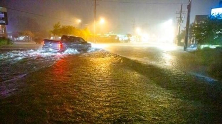
For the second time in a week, a tropical disturbance became a named storm almost at the point of landfall. Disturbance Four became tropical storm DANNY as it ran ashore close to Hilton Head some 40 miles south of Savannah around 2000 hours local time last night. This is not a new trend but may be simply more accurate measurement and reporting. Despite the upgrade, this was a kitten-weak storm but did produce some heavy rain with localised flooding in places. For those who crave details (or maintain sweepstakes) DANNY produced a hurricane severity index rating of just 3 out of 50 at peak, that is 1 for size and 2 for intensity, which translates into winds gusting 55 knots and a tropical storm windfield radius of 50 miles. DANNY weakened almost immediately on landfall.
Disturbance Twelve is now centred around 800 miles due north of the mouth of the Amazon, westbound at 18 knots. Aerial imagery shows mixed signals with an increase in thunderclouds, indicative of convection becoming organised and swirls of surface rotation which would both be clear warning signs. On the other hand, streaks of high level cloud indicate the presence of upper level shear, which is likely to increase the further this travels west. There is still considerable doubt that this will develop as it approaches the Caribbean, but is certainly showing some enthusiasm.
Disturbance Fourteen is now a day and a half steaming west of the Cape Verde Islands moving west at 18 knots. This is still rather disorganised but satellite images show a hint of rotation and very high water content. More wind shear awaits but conditions may be favourable if this can retain shape and characteristics before reaching the Caribbean by the weekend. Early days.
Stand easy.
Image Lauren Phoenix